
Poland is Berlin and Brandenburg’s closest European neighbour and plays a prominent role in the cross-border work of both federal states. The Berlin-Brandenburg capital region and the voivodeships in western Poland are connected by a wide range of structural relationships and interdependencies. Shared opportunities and challenges in the areas of transport, structural change, climate protection and adaptation, energy transition and water management require close coordination and collaboration in spatial planning and development. To this end, the Joint Spatial Planning Department (GL) is involved in various cooperation and exchange formats as well as various projects that deepen mutual cooperation and develop innovative solutions for the shared future.
 Bild: Wikimedia Commons
An important format for German-Polish cooperation is the German-Polish Intergovernmental Commission for Regional and Cross-Border Cooperation, in which representatives of the German federal and state governments as well as representatives of the Polish government and the voivodeships intensify institutional cooperation between the two countries on various topics. The Commission meets once a year, alternating between Poland and Germany. Its work is intensified and supported by four committees.
The Joint Spatial Planning Department Berlin-Brandenburg is represented in two of these committees: in the Working Group Transport of the Committee for Cross-border Cooperation, the GL supports cooperation in the transport sector with its expertise in spatial planning.
A particular focus of the GL lies on the Committee for Spatial Planning Issues, which is co-chaired at national level by the Federal Ministry for Housing, Urban Development and Building and the Polish Ministry of Funds and Regional Policy and in which the federal states of Berlin, Brandenburg, Mecklenburg-Western Pomerania and Saxony and, on the Polish side, the voivodeships of West Pomerania, Greater Poland, Lubuskie and Lower Silesia work together.
Within the Committee for Spatial Planning Issues, the GL has held the chairmanship of the Working Group for the Implementation of the Common Future Vision for the German-Polish Interaction Area since 2022.
The Joint Spatial Planning Department Berlin-Brandenburg represents the interests of the Federal States of Berlin and Brandenburg in cross-border cooperation on issues relevant to the development of the joint interaction area in the Committee for Spatial Planning Issues of the German-Polish Intergovernmental Commission. In 2016, this committee developed the 2030 Common Future Vision for the German-Polish Interaction Area, which outlines a vision of the joint interaction area in 2030 that serves as a basis for further cooperation to lead the area on both sides of the Oder and the Lusatian Neisse into a shared future.
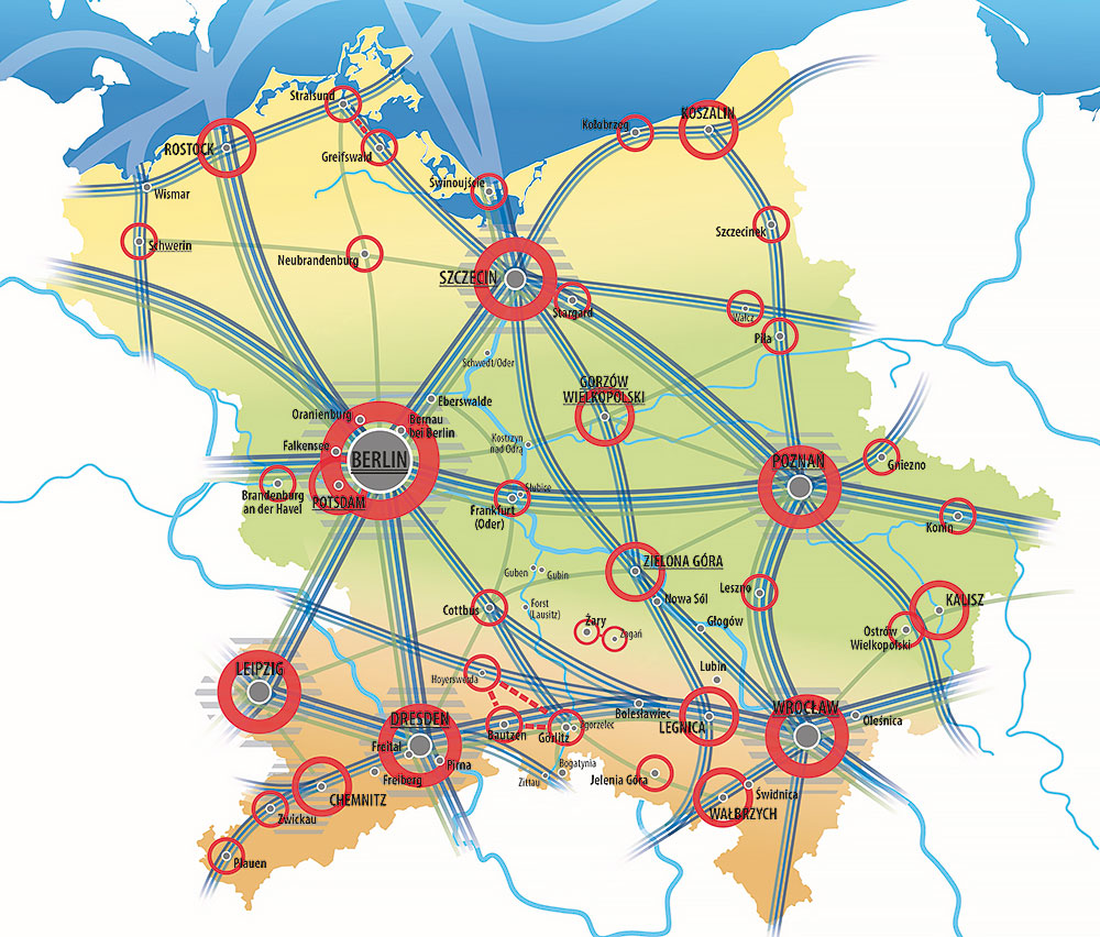 Bild: Ausschuss für Raumordnung der Deutsch-Polnischen Regierungskommission
To this end, a Working Group for the Implementation of the Common Future Vision was set up in 2019 to work with the institutions represented on the Spatial Planning Committee to elaborate this vision and to initiate and support projects and activities aimed at strengthening the potential of this region at the heart of Europe and overcoming challenges together. The members of the Spatial Planning Committee have also already agreed to update the Common Future Vision beyond the year 2030.
A German-Polish spatial planning portal, which is operated by the Federal Institute for Research on Building, Urban Affairs and Spatial Development on behalf of the Federal Ministry for Housing, Urban Development and Building, provides information on the work of this committee.
A first joint project of the 2030 Common Future Vision Implementation Working Group was the creation of German-Polish railway maps, which were published in 2022 by the Spatial Planning Committee.
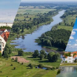 Bild: Adobe Stock / MaciejBledowski / mariusz szczygieł / Tilo Grellmann
The development of the polycentric settlement structure is a particular concern of spatial planning cooperation in the German-Polish interaction area. With a population of around 400,000, Szczecin is the largest city on the German-Polish border and at the same time the closest major city to Berlin. Inter-municipal cooperation in its metropolitan region has so far mainly developed on the Polish side, but the metropolis of Szczecin increasingly gains cross-border appeal. The expected completion of the upgrading of the Berlin-Szczecin railway line will only add to this appeal, as well as opening up development opportunities for north-east Brandenburg.
In 2015, the Joint Spatial Planning Department Berlin-Brandenburg was involved in the creation of a development concept for the cross-border Szczecin metropolitan region. On the German side, the further development of this cross-border metropolitan region is advanced by the Office for the Szczecin Metropolitan Region, a joint organisation of the Federal States of Brandenburg and Mecklenburg-Western Pomerania. The GL is represented on the advisory board of this office and also participated in the already completed Interreg project on innovative data collection measures in the Szczecin metropolitan region (Cross-border Monitoring Model), which aimed at formulating better policy recommendations for the development of the region.
The interaction area of eastern Brandenburg and the Lubuskie Voivodeship is facing common challenges of structural and demographic change. The cooperation project BB‑L Interconnection aims to strengthen administrative cooperation and interconnection in this region in the field of spatial and regional development. The spatial conditions of this shared region will be analysed and a joint vision for the future developed. In addition, joint structures for cooperation, the exchange of experience and the transfer of knowledge are to be created and consolidated. The GL implements the project together with the Marshal’s Office of the Lubuskie Voivodeship (Department of Geodesy, Real Estate Management and Spatial Planning) and the Brandenburg University of Technology Cottbus-Senftenberg (Department of Regional Planning) in the period from April 2024 to March 2027.
 Bild:
Bild:  Bild: Oder-Partnerschaft
The future of the shared region on both sides of the Oder river is also being shaped in the informal network of the Oder Partnership, which brings together the Federal States of Mecklenburg-Western Pomerania, Brandenburg, Berlin and Saxony, as well as the voivodeships of West Pomerania, Greater Poland, Lubuskie and Lower Silesia. With the aim of promoting the close interconnectedness and dynamic economy of the region through project-oriented work, the network regularly brings together actors from politics, administration, civil society and the business sector from the participating federal states and voivodeships. In addition, a political summit is held every two years, most recently in Berlin in June 2024. On this occasion, the chairmanship of the partnership for the next two years was also passed to the Greater Poland Voivodeship. In addition to the website, a newsletter also provides information on current developments and topics in the regions of the Oder partnership.
 Bild: Adobe Stock / flashpics / powell83 / netsay
In addition to its close cooperation with the voivodeships in western Poland, the Joint Spatial Planning Department Berlin-Brandenburg also maintains a friendly working relationship with the Mazovian Office for Regional Planning in Warsaw.
As part of the Interreg B project MECOG-CE – Strengthening Metropolitan Cooperation and Governance in Central Europe, led by the City of Brno (Czech Republic), the Joint Spatial Planning Department also cooperates with the Warsaw City Administration and the University of Silesia in Katowice as well as other partners. The project involves a mutual exchange on methods and practices of managing metropolitan regions with the aim of improving the integrated and strategic development of these regions.
As lead partner of the Interreg B project H2CE – Empowering H2-ready regions in Central Europe, the Joint Spatial Planning Department cooperates with the Pomeranian Voivodeship, among others. The project aims to empower public administrations to integrate hydrogen into regional energy planning and thus proactively manage the energy transition in their region.
In the past, the Joint Spatial Planning Department has also been involved in various other cross-border projects aimed at improving the development of the common interaction area.
In close cooperation with the Marshal’s Office of the Lubuskie Voivodeship, the GL participated from 2022 to 2023 in a pilot project of the Territorial Agenda 2030 steered by the Polish Ministry of Funds and Regional Policy. The project, titled ‘Understanding how sector policies influence spatial (im)balances’, aimed at identifying the potential spatial impacts of an upgrading of the cross-border railway connection between Berlin and Gorzów Wielkopolski (Ostbahn/Route 203) by means of a Regional Territorial Impact Assessment, thus contributing to future transport planning. The main results of the impact assessment are that an upgrading of the line would significantly improve the (cross-border) accessibility of places of work and residence, settlement centres and recreational destinations by public transport and lead to associated positive effects on the climate. The upgrading of the line would also lead to increased settlement development and tourism as well as improved locational conditions for trade and industry in the region of eastern Brandenburg and Lubuskie.
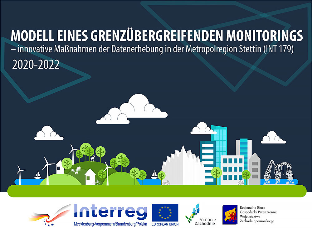 Bild: Regionales Raumplanungsbüro der Woje-wodschaft Westpommern
To further develop the cross-border Szczecin metropolitan region, the Regional Planning Office of the West Pomeranian Voivodeship initiated the Interreg A project ‘Cross-border monitoring model – innovative data collection measures in the Szczecin metropolitan region’, which ran from 2020 to 2022 and in which the Joint Spatial Planning Department also took part. Based on an understanding that the elaboration and implementation of the development concept of the cross-border metropolitan region created in 2015 requires a comprehensive data basis, a methodology for collecting, harmonising and managing data in the metropolitan region was developed with the involvement of relevant stakeholders from both countries. The project strove to enable actors involved in the development of the metropolitan region to access comprehensive and up-to-date data on the topics of transport, urban-rural relations, tourism and the economy and harmonise their planning activities accordingly.
